Wednesday, June 26, 2013

Seg #19 Green Bay Green Leaf/Fox River Trl (Hilbert-Pulaski, WI)


Start
Hilbert, WI
N   44.16894W-88.15981
N-S miles27.5 mi*

End
Green Bay, WI
N  44.56466,W-88.06475
Trl lgth30.3mi Ride 47.9mi

Ride hrs 4.9
AVS 9.8
MXS 13.5
KCAL 3645
Temp 82
El 808

After a good night’s sleep and a carbo loaded breakfast at the Country Suites, we saddled up and headed north to the southern trailhead of the Green Bay-Greenleaf/Fox River Trails. The nearest town to the trail is Hilbert, WI. It was after 10 a.m. before I got on the trail.

 
This trail is a Rail to Trail route meaning gradual elevation change, an average of 6% slope and tree canopies from over a hundred years of growth. I like Rail Trails because the trees provide a wind break, shade and wildlife.  
Native Americans followed by
French explorers, used this
route long before railroads

The Fox River Trail corridor has a rich history, beginning with the Native Americans who used footpaths to travel between their villages located along the Fox River. The early French explorers, missionaries, and traders built their posts and missions along these trails. As the area was settled, livestock and other goods were brought to market using these pathways. Later, a military road was built along portions of the corridor linking Green Bay to Milwaukee. In the 1860’s the Milwaukee and Superior Railway acquired the present corridor and began planning for rail service. In 1873, the Milwaukee and Northern Railway Company purchased the corridor and the first trains began making regular runs between the Green Bay and Milwaukee markets. Trains would continue to run on the corridor for the next 116 years as ownership passed from one railroad to another. In 1989, regular rail service was discontinued, signaling the end of one era, and the beginning of another with the development of the Fox River Trail. After riding two hours, I met Connie for lunch at the Scray Cheese Company, Depere, Wisconsin. There are numerous similarities between this company and the Kolona Cheese Factory just down the road from where we live in Coralville, Iowa. The Kolona factory has a better viewing area to watch the workers make all kinds of cheeses. Scray’s 1926 start precedes Kolona by twenty years. Kolona has a dense population of Amish and Mennonites so guess who built the plant?


Connie smiling with the Scray Cow.
This preceded the "no smile, no
fun" part of the day.
We had a lunch of string cheese and summer sausage---mmm good! Probably it was too good and caused me to forget my gloves in the restroom.  Good thing was I noticed I left them only a couple miles away. Connie drove me back Scray’s and I ran into the men’s room to recover my gloves. I was focused on not allowing my clips touch the nice wood floor so I didn’t bother to look around. I had no reason to look around once I recovered my gloves---no that is not correct! I headed down the trail and Connie drove ahead to Pulaski, the end point for my ride. Unfortunately when Connie went to buy to by a Diary Queen cone, she realized she had left her purse at Scray’s under the table where we ate our lunch. She called me but I had ridden into Green Bay about ten miles north of Depere so she could drive back quicker than I could ride back. In retrospect I should have called Scray’s to confirm the purse was still there and then both of us would go back for the purse before they closed. Since the GPS Momma, Dixie, had directed her to Pulaski, I thought she could get her back to Scray’s using Dixie. Dixie was in a bad mood I guess, spilling out wrong turns. As it was, poor Connie got thoroughly lost and spent hours trying to find Scray’s and recover her purse and then had problems finding her way back to Pulaski. Both Dixie and I were in the doghouse when Connie finally rolled into our meeting point in Pulaski. I hope I haven’t lost my driver, but it doesn’t look good.


Fox River North trailhead in Green Bay. This
river snatched a former neighbor, Michael
Philbin a couple of winters ago. I thought of
him as I rode up the trail.
Riding along the Fox River caused me to pause and reflect on a tragedy that occurred here in the winter of 2012. A former neighbor directly across the street, Michael Philbin, was partying with friends and somehow became separated from his buddies. He decided to cross the ice covered Fox River in the dark. The river was not frozen enough to allow safe crossing and he slipped away to his death. I played some one-on-one basketball and golf with him and his brother Matt. Their dad Joe is now head coach for the Miami Dolphins. Joe’s prophetic words ring true now and forever. "Michael was alone when this incident occurred. For us as a family this has been the most difficult thing to deal with. Had he been with someone this would have been avoided. The message is clear: practice moderation in the consumption of alcohol, avoid illegal drugs, and if someone appears to be in need of assistance, help them so that this situation doesn’t occur again".
The Fox River Trail ends in Green Bay leaving a large gap before connecting to the Mountain Bay Trail in Howard, WI. I was able to ride 4 to 5 miles on city streets, avoiding highways and roads where speed limit matched or exceeded 45 mph. That is the whole idea of my Border to Border ride, safer trails versus car and truck roads and highways. I beat Connie to Pulaski, so I rode around a town dominated by a Assumption of the Blessed Virgin Mary Catholic Church. As one might assume, Pulaski was settled by Polish immigrants settled this area of Wisconsin in the 1800’s. Pulaski is also the name of the fire fighting tool I used in the Forest Service. Maybe that is why I am drawn to the name and the town. The axe is named after Ed Pulaski, famous for taking action to save the lives of a crew of 45 firefighters during the disastrous August 1910 wildfires in Idaho. From a group of 35 families, the town today has a population of over five and a half thousand and the church has expanded to a building that measures 198 feet by 74 feet. The twin towers rise to a height of 135 feet. This is quite a sight for being ‘off the beaten path”.
I was mesmerized by this church when riding through Pulaski, Wisconsin. The design suggests Polish influences and that is just what it is---a Polish Church---reminds me of Krakow.


I was mesmerized by this church when riding through Pulaski, Wisconsin. The design suggests Polish influences and that is just what it is---a Polish Church---reminds me of churches we saw in Krakow. The Village of Pulaski was named after Count Casimer Pulaski, the great freedom fighter of Europe and America. Pulaski fought the Russians in his native Poland from 1770 to 1772. He later fought with General George Washington at Brandywine. Pulaski found an independent cavalry corps (Pulaski Legion). For this reason, he became known as the Father of the American Cavalry.


Monday, June 24, 2013

Segment #18: Clyman-Fond du Lac Wisconsin


Start
Clyman,WI
N 43.34309,W-88.714710
N-S miles 28.5mi
End
Fond du Lac, WI
N43.75215,W-88.46676
Trl lgth 34.5mi Ride 37.2mi
Ride hrs 4
AVS 9.2
MXS 17.5
KCAL 2996
Temp 84
Elevation 815-885

Southern trailhead North of Clyman Junction, WI, adjacent to a
model airplane airport where flying fanatics fill the skies. 
After stopping at the Maquoketa Lumber Company to visit Brother Ted (#3 of 8 Maze boys), nephew Mark and Bicycle Mark, Connie drove me to Wisconsin for the first of three rides. Dixie, voice of the GPS, got us to the trailhead without a hitch.
 
Wisconsin fly boy with his remote controlled
airplane. This little baby is 10x larger and
200X more $ than my brother Don's red paper
and balsa wood 1955 beauty.
After chatting with a couple of fly boys with their toys, I headed out on what is described as a smooth trail. The Wild Goose follows an abandoned Chicago and Northwestern Railroad corridor, therefore it is quite flat, however, the southern quarter of the Wild Goose was not that smooth for me. Horse riders are to use a separate trail on the side of the bike trail but, the piles of “horse-puckie” and jolting speed bump-like divots in the trail told me these equestrian folks were riding full bore down the bike/walking path. After my rough road tune-up, I found the rest of the trail excellent, even the half mile section where the trail switched from hard limestone to a non-descript grass corridor.
Where's the trail?

Looking back, I imagined a line from the stone path to where I was in the grass. Keeping that line in mind, I wheeled the bike forward and made my own path in the shoulder high grass. It appeared the trail was to go through a lush thick field of wheat or barley (probably barley since up until 1940, Wisconsin was the biggest producer of barley and there is mega gallons of beer brewed in the state).
 
 
Barley for the beer drinkers---lot's of them
It would not make sense that a farmer would plant across the trail, yet anti-trail people do some pretty annoying things to express their disdain for recreational trails. It seems as if the tension between land owners and trail users has eased from the early days of trail building. I remember riding the Wabash Trace in the 80’s and seeing a bunch of nails tossed on the trail.
 
 
Rife Range warning!!
Horse riders deal with bicycles and other irritations such as hunting and shooting ranges close to the trail. A sign on this trail warned of horse spooking from a rifle range.
 
The highlight of the Wild Goose Trail is the proximity of the trail to the Horicon National Wildlife Refuge, a 32,000 acre wetlands serving as a safe haven for 500,000 migrating birds. It would be nice to go back to the Wild Goose Trail in the spring or fall. One of our fond memories of Nebraska is the espying of more than a half million Sandhill cranes that spend a month in the Platte River basin foraging and resting before flying on to Canada to nest and raise their chicks. The Sandhill cranes have been doing this for ten million years. Witnessing this journey is once in a lifetime event.

The thirty-four mile trail ended in Fond du Lac on several miles of asphalt. There was a convention in town so if Connie had not gone ahead and found the last room at the Comfort Suites, the trip would have started off on the wrong note. In other words, I was pooped after riding thirty-seven miles.

Those following my blog will notice I have added another line of data. I figure that since my bike computer gives me distance, riding time, kilocalories burned, average speed, maximum speed, temperature and elevation, I might as well record it. Maybe someone with benefit from my pedantic compulsion to record everything recordable.

Saturday, May 25, 2013

Segment #17 The last bit of Iowa Latitude


Seg #17 Raccoon River Trail: 5/24/13 (Last Iowa Latitude, 1st Mile Stone)

Start
Yale, Iowa
N 41.77224,W-94.35327
N-S miles 10.3mi*

End
Cooper, Iowa
N41.92006,W-94.34532
Trl lgth 57mi Ride 10.6mi

 This ride is the last one I need to pedal in Iowa. All the Iowa latitudes have now been ridden---mile stone #1. It was a comfortable seventy degree but windy day in west central Iowa for this ride a few days before Memorial Day. Connie drove me from Coralville to Yale, Iowa, a three hour trip. After unloading bike and gear, I was off pumping north toward Jefferson. The Raccoon River Trail is a well maintained fifty-seven mile north-south path that originates in Clive, Iowa (north and west of downtown Des Moines) and terminates in Jefferson. I only needed to ride a ten mile segment from Yale to Cooper. Thank goodness the wind was as forecasted, a fifteen to twenty mile per hour gale out of the southeast. With the wind at my back, I sailed along at record speeds; at least it felt like record speeds. I lost my bike computer that captures speed, distance, calories spent, etc., so I can only estimate that I averaged four to five miles per hour faster than my normal eight miles per hour. There were many song birds flying ahead of me and woodchuck that wanted a race. He was a good sprinter, out running me for a short distance before diving into the underbrush. The farmers were working frantically in their fields. The cold wet spring has them two to three weeks behind schedule. How farming has changed from my days. Every field is five to ten times bigger than the 1950’s and 60’s. Most fences have been ripped out so that the only field border is the ditch of adjacent county roads that generally surround each section of land which is six hundred and forty acres. Huge tractors pull equipment planting ten times the crop from my day. Gazing across the landscape, numerous areas of premium black soil stretched beyond what my eye could see. Back in the day, this rich farmland averaged $300 per acre; it now averages $8000 per acre. No wonder the 160 acre farm of the Maze days, which was considered above average when my grandpa Maze bought it in 1883, is now a farm you cannot make a living, at least growing crops. After the ride, we had lunch at the Uptown Café in Jefferson and then drove to my home town of Carroll, Iowa.   

We bundled this bike trip with a Memorial Day visit to the graves of my parents, George and Gladys Maze, grandparents and friends. We were impressed how nice the Carroll City Cemetery looked with a blaze of flowers, American flags and military markers. It was moving for me to visit the grave of my childhood friend Martin Tan Creti. Marty lost the battle against lung cancer in 1997 at the young age of 51. Creti as I fondly called him, had a great sense of humor and perfect sensitivity as to when to be caring and when to be funny. I remember when he told me how I should be proud my dad wanted to play the bagpipes at the last Carroll High football game---“Don’t be embarrassed Mazer, I would be so gratified if my dad would do such a thing.” These words kept me from running away or some other ill advised step to escape humiliation. Marty was a smart guy and often gave me tips on understanding nearly every subject, especially math. Whenever possible, I would take advantage of the invitation to study together at his house after school and before chore time on the farm. We would go up stairs to the library and pour over our homework. The Tan Creti’s put a premium on education and good grades, so the library was perfect environment to learn. Marty’s older brothers were top notch students. Mike was first or second in his class and Marc was 1961 valedictorian by a long shot. So the pressure was on for Marty to perform at similar levels. He did rank as top male student in the class of 63 but there were six girls ahead of him and eight ahead of me. We kidded each other about being numero uno of the Class of 63. Even though Creti didn’t rank with his brothers academically, he was more rounded because he played football, threw the discus in track and dabbled with acting on the Carroll High Stage. Marty started and ended his acting career by joining Ron Pomroy (Pomer) and me in a one act play, The Cracker Barrel. Although this was a serious play with a murder, the audience didn’t fall for a somber production with likes of us three ying yangs on the stage. So after I blasted Pomer with a couple explosive shots from a 22 caliber pistol loaded with blanks with a gun I brought from home---try that today!--- the kids that knew us just laughed! No Tony Awards for us.
Cracker Barrel Crack ups. Can you imagine
using a gun from home like this today? Creti
in the white hat, Pomer no hat and Gunner Maze

That should have given me a clue that I wasn’t a convincing actor but I went back for more playing a role of Roger (I think that was my character name) in a comedy Onions in the Stew written by Betty MacDonald. This play was the last of the year. I was a senior with a bit of senioritis. Therefore I didn’t study my lines or commit to the role. One scene had me coming on stage with bee veil plopped on my head. As I entered I ramble out my lines and Nina echoed her lines. But as the scene wore on, my confidence was waning. First I had read my lines just for going on stage---a no no in thespian terms and second Nina and I were the only actors on the stage. No one could bale me out. When it was clear I could not use the fail-safe of lost lines by saying, “is there a cookie in the house?” to the right stage prompter and “is there a magazine in the house” to the left stage prompter. How could I ask for either of these when I had a bee veil over my eyes and mouth? Instead I went into a tirade of adlibbing. Line after line I made up what I was supposed to say. As I stood at center stage and peered out over the audience, In the back row I spotted a bright red glow, probably someone inhaling on a cigarette; smoking was acceptable about anywhere back then. I am not certain how long it took to move on with the other characters, but the scene I made a scene, extended more than twice as a long as it should have. As I crumbled off stage from my boo boo, I thought, “I bet that red glow was Mr. Knot sucking a Camel straight as he freaked out over my stupidity. Mr. Knot was my English teacher and Drama coach. He had us senior goof offs figured out so he used a different style to teach us. When the play was over and the cast gave him a present and he thanked everyone, he called me out of the cast to come forward. “They say every play performance is a learning experience and I think the one that learned the most is Glenn Maze---Glenn come forward.”  “No!” I said to myself and thought of hiding behind the back curtain. But I was exposed and had to fess up. I am certain my face glowed every bit as much as Mr. Knot’s cigarette. His final words to me were, “Good Job Glenn.” No wonder I am skeptical of compliments.

Wednesday, May 22, 2013

Maze Bike Ride Two (MBR2) Seg #16 5/10/13


Seg #16 Prairie Spirit Trail: 5/10/13 (MBR2)
 
Start
Humboldt, Kansas
N37.77661W-95.42931
N-S miles 35.4mi*

End
Garnet, Kansas
N38.28587-95.24903
Trl lgth 38.8mi Ride 43mi

It first looked like an easy ride. NOT!!!!

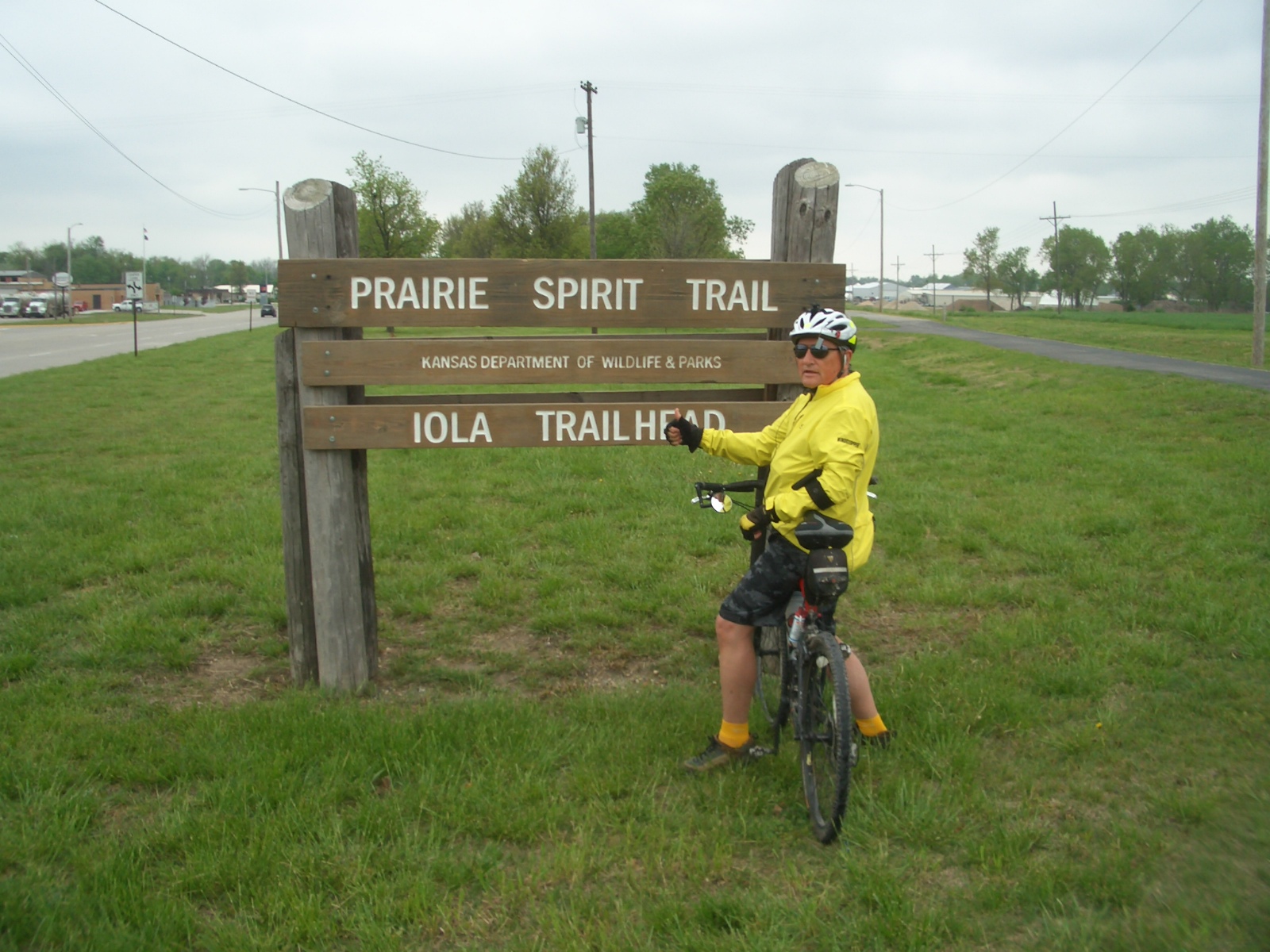
It was a short night in Iola, despite sleeping-in for an extra hour to give Geoff’s PDT(Pacific Daylight Time) body a little break. The weather report before I headed to Kansas forecast southwest winds and temperatures in the eighties. But that wasn’t the way it shook out on Friday morning. The temperatures were in the low sixties with a twenty mile per hour the northwest wind. Boo! Hiss! The hotel was only a few feet from the Prairie Spirit Trail (PST) which appeared to be a hard asphalt surface. No sooner had I rode less than a mile, the asphalt trail became a bumpy grass path formed by a vehicle or two using the trail for something beside recreation.  Once the hard surface trail ended, my predicted one hour ride was nixed and so was the idea that Geoff could meet me in Humboldt in an hour; instead I was in for a tough two hour ride. There were barricades placed at every point the trail intersected county roads, roughly a dozen orange fences to keep out hunters? 
I wasn't hunting---just went around such fences
After going through the first barricade, it was clear that new crushed limestone was being laid. This new surface was not as compacted as it needed to be. With recent rains and lack of compaction, this Maze Boy had a major workout riding a beach soft trail for nine miles. This type of trail saps one’s energy and lends itself to even more pokiness in achieving an one hour ETA.  It was 11:30 before I got to Humboldt. To meet Geoff at the proper latitude, I needed to ride south of Humboldt, a mile or two on a street that turned into a road. For a short stretch I was brushing shoulders with huge 50 ton concrete trucks pulling out of the Monarch Portland Cement Company. What a big operation for a small town! This is the first time since starting this journey that I had to ride a street that really didn’t qualify as a street or trail. Unfortunately I expect to find myself trapped into riding a road or highway once in a while. I hope not more than a mile or so. The goal is not to ride where vehicles are traveling above 45 miles per hour. When I got to 1200 Street and Connecticut Avenue, Geoffer met me and we threw my bike on the carrier, sequestered  a sandwich from the Iola McDonalds and then father and son rode north towards Garnet, KS. Geoff rode thirteen miles north and then turned around and rode twice as fast south with the wind at his back. With a stinky headwind, the three hour ride became a four hour and half hour ride just to make it to Garnet, short of my goal. I had eight more miles to reach the target latitude of 39.39997 near Richmond, KS. Since the Los Angeles Kings hockey team was playing the St. Louis Blues in the Stanley Cup Playoffs, and Geoff wanted to get to Chris’ house to watch the game (both my boys and their buddy Brian are huge hockey fans), therefore the last eight miles were shelved and we took off for Chris’ house in Runnells. Most of the route back to Iowa was interstate, so Geoff put the pedal to the metal (80+mph) to make the five hour trip a 4 hour trip. We missed the start of the game but caught all the goals and witnessed a Kings win to take the first round of the playoffs. Everyone at Chris’ house whooped it up, high fiving, back slapping and cursing with jubilation. I sat there a bit dumb founded by the antics of forty plus year old men. Next for the Kings is the San Jose Sharks. Will the Kings capture the Stanley Cup a second year in a row?  

Ian with Dad, Uncle and GPa. Fore
The next day was a major sleep in for all fellows at 8930 Vandalia Road. When we finally got moving, Chris, Geoff and grandson Ian took me mini-golfing. It was windy as heck so some of our putts required hitting a moving target. Ian won the back nine and his dad won the match. Ian is becoming a good golfer at age 13.

Tom as in “Got Tom” aka “Got Milk”
Niece/Cousin Maia, graduated from Iowa State University on Saturday. A geneticist no less! We joined Maia and her family for a nice meal at Aunt Maude’s in Ames. A few days later, Connie and Tom visited the graves of family members in Norway, West Amana and Watkins. Connie gave Tom the "Got Tom"tee  shirt Geoff brought from California.


25 year hiatus. This year made up for it!
May 12th was a special Mothers Day for Connie. Chris and Geoff were home for the day for the first time in twenty-five years---1988. MBR2 didn’t go as smoothly as MBR1 but the family fun associated with it, really made this a very special week.

Maze Boy Ride #2 (MBR2) Little Blue Trace Seg #15


Seg #15 Little Blue Trace: 5/9/13 (MBR2)

Start
Lee’s Summit, MO
N  39.14915W-94.31562
N-S miles 9.1*
End
Raytown, MO
N   39.00784W-94.17176
Trl lgth 16.1 Ride 32.3mi

 
One year ago, Chris, Geoff and I were ferried over to Anniston, Alabama to complete the Chief Ladiga-Silver Comet trail. This was Maze Boy Ride #1 (MBR1)The original plan for MBR2 was for me to bike one way and Chris and/or Geoff to ride roughly half way and then ride back to the car and drive to pick me up at the trail's end. Once it was clear that Chris could not participate in MBR2; he was still suffering from hernia surgery just two days prior, he had to stay home to recuperate. The good thing was the hole in his stomach muscle was small enough that repair could be done with suture alone---no mesh or other devices needed.  So I did another rain pounding drive with nasty trucks to Lee’s Summit, Missouri. By the time I reached the Iowa-Missouri border, the rain had let up and clear skies appeared for the rest of the day.

The Little Blue Trace Trail follows the course of the Little Blue River for 11 miles through the Little Blue Trace Nature Reserve. The trail serves as recreational and commuting trail for residents in the Lee’s Summit and Raytown, Missouri suburban communities east of Kansas City. I think my dyslexia lead to a two hour delay in finding the northern trail head.  Dixie, as I fondly refer to my GPS co-pilot, tracked my coordinates to an area of Rednecksville in the boonies. She kept me going to areas where all she could say was; “You are currently in an area where step by step directions are unavailable. Follow the arrow on the screen”. Well Dixie, that does not help when there arrow doesn’t appear to point to anything. So when I ended up in an area where NRA, No Trespassing, Keep out and other uninviting signs populated ever fence, gate and pole, I knew I must be in the wrong area. But just for spite I decided to get out of the car and inspect the small print below the “Keep Out” sign. I was sure the gate was put barricading the trail. As I read the fine print stating, “And this means you”. A wiry old codger pulled up in his rusted-  out Buick LaSabre with one bent wiper. “Hey” he said with a gap tooth grimace. “What ya doin’ har?” “Looking for the Little Blue Bike Trail I said”. “Aint nar bike tray rund har---all private prop”. After a few apologies from me, he started gabbing about the weather, where I was from and so on. I decided he enjoyed having someone to chat with so it was hard to excuse myself. I slowly eased myself back on the road, with him chatting the whole time. I could still see his lips moving in my rear view mirror a hundred feet down the road.
Using maps and asking folks, two hours later I finally found the northern trail head of the Little Blue Trace.  What beautiful setting especially in the spring time. The trail is mostly paved paralleling the Little Blue River. The lush grasses were an unusually velvet green, almost cloud-like. With large bright yellow patches of the wild mustard and bunches of purple radiating from the wild phlox beneath the trees, the scene was set for a beautiful ride.
 
Some of the beautiful wild flowers found along
the Little Blue Trace Trail in NW Missouri
Since I took so long to find this trail, I decided I would not have time to drive another hundred miles south to ride the Frisco-Highline Trail near Springfield, Missouri. So Inside of hiring a cab to get back to the trail head, I decided to ride sixteen additional miles back. I had time to kill waiting for Geoff’s Kansas City flight to touch down from LA. It was a good workout and enjoyable. Geoff’s flight was delayed until 10:30 CDT. That made for a late drive to Lola, Kansas. I was glad Geoff was not as tired, it was 8:30 for him, and was willing to drive. I hate driving at night. It was 1 a.m. by the time we hit the rack, making for a short night.

Friday, May 3, 2013

Best Made Plans:

Winter has been too long this year; in fact it has gobbled up a chunk of spring already. Less than a hundred miles northwest of Coralville, it snowed thirteen inches in Osage, Iowa and southeast Minnesota was hit with 15.7 inches, both all time records of the pretty yet annoying fluff.

light dusting (15+ inches) of snow on the deck furniture
in Wisconsin

Due to the cold rainy weather my plans for today, planting flowers we bought yesterday from the Amish in Kolona, has been put on hold, along with training rides for the 2nd Maze Boy Ride (MBR-II) next week.

Poor Chris popped a hernia a couple weeks ago and has repair surgery scheduled May 7th, just two days before the MBR-II. We are thinking that bike riding will be out of the question for Chris so Geoff and I will ride the three Missouri and Kansas trails on the schedule. Hopefully Chris can drive the car, dumping us off at one end of the trail and picking us up at the other end. I will post the outcome of the MBR in a couple weeks. In the meantime I can try to make sense out of derailleur adjustments videos on U-Tube. I can see why bicycle mechanics did not go into teaching or maybe it’s the student?!