Thursday, May 15, 2014

Seg #37 The False Cape State Park Trail; A Survival Ride

Seg #37 False Cape State Park Sand Ridge Trail  5/9/14  Back Bay Nat.Wildlife Refuge
End
North Carolina Border
N 36.51490 W75.87583
N-S miles 11.1
Start
BackBay Entrance
N 36.67447 W75.91716
Trl lgth 21.2mi Ride21.2mi


Ride hr 3:02
AVS 1.2
MXS  mph 6.7
DST 21.2
Tmp65-85
Kcal 1753


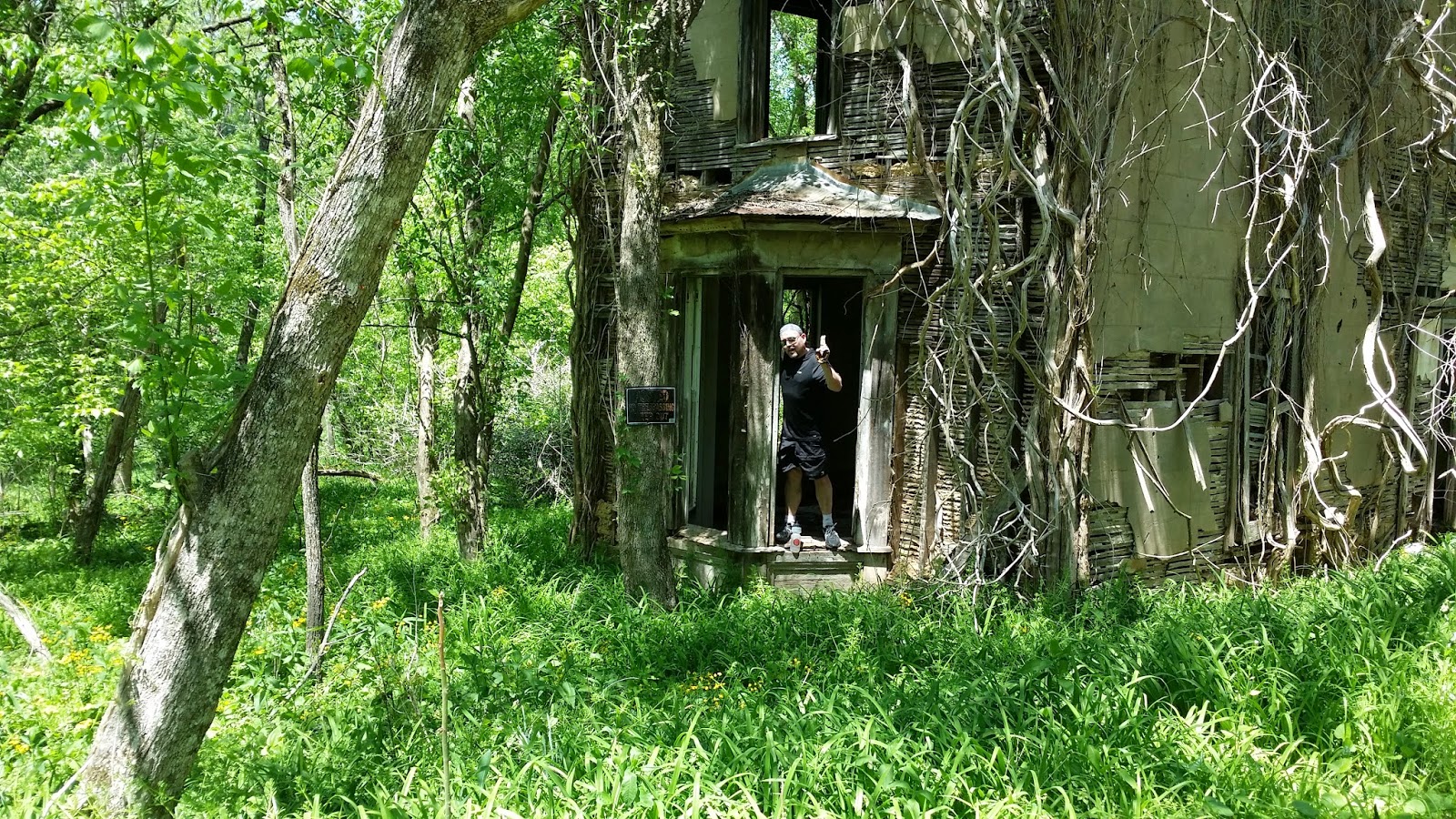
This is the start of the False Cape Trail. It ends at the North
Carolina border at the beach. A tough trip for the Maze Boys
We headed out of the Richmond Days Inn sometime after seven. Given Google Maps said it was over two and a half hours driving time so we had to kick it in the tail-feathers it to get to Virginia Beach and False Cape State Park by 9:30 a.m. The trailhead was somewhat remote but Trixie, my GPS Queen, got us to the north gate of the Back Bay National Wildlife Refuge before ten. The park ranger said it was a four mile ride to the Visitors Center at False Cape State Park. You can't drive into the park so we rode the four miles to the park  plus another four or five miles to get to the beach via Wash Woods Trail. Pushing our bikes through sand dunes is no cup of tea but that is what we did for a half mile.

Chris is the red dot near the top of the dune. This sand is too
soft to ride and a challenge to push a bike.
I was astounded that once we got to the beach, there was not a human being insight for as far as I could see in any direction. Never have I been on a beach, at noon, on a sunny warm day and not see anything but birds and rolling waves. We were able to ride for about a mile but as the tide started to rise, the and the previous packed sand started to dry into a weak crust, it was impossible to ride the bike. We kept walking our bikes thinking we would find areas we could ride but after another two miles of struggling to get to the North Carolina border, I was out of gas. Chris was more than a mile ahead of me by the time I  decided I would be in big trouble if I kept going. Especially trying to get back to the car. Flailing my my helmet to signal Chris to stop and return was not working---he was too far from I guess. Even though he later told me he was going to get to North Carolina come hell or highwater; and the water WAS getting higher;
I could ride this sand for less than a mile. We were headed
to North Carolina (it is beyond what the eye can see over
my left shoulder). Chris made it to the border but I must
find another trail in states I have yet to ride to pick up  latitude
Rebecca and her crew saved us on that day on False Cape
Beach. I look better than I feel. Damn that was hard on us.
Chris is no where to be seen.
 he said the fence at the border was like a mirage. He just kept going. It was nearly impossible to read the screen on my phone but I tried to phone and text him. No answer. No Wonder, he left his phone in the car. It was nearly ninety degrees and drinking water was gone. Chris was dead set on getting to the border even though I was not going to make it. I hope I can make up the missed latitude somewhere close to other trails. I am not driving 2,500 miles just for three miles of latitude. Chris finally made it to the border and started back toward me but he was out of water. Dehydrated, he became dizzy and confused. Thank goodness I had a couple of swigs of water left. But we were in no shape to get back.

Water! WATER!!! YES WATER!!!! Chris is pretty much
dehydrated so he is a bit goofy not being of clear mind
and nauseated to boot. Thank the lord we got a ride.

Was it a mirage or did we see a pickup truck a couple miles down the beach?  We headed toward the truck and found the nicest people in the world, especially since we were in such tough shape. They were park workers installing gypsy moth traps in the sand dunes.  After catching his breath, Chris went ahead and signaled them down.explaining our dilemma. Rebecca, the ranger and team leader was willing to haul us back to the Sand Ridge Trail. Wow, was that ride a lifesaver. They gave us water and hauled us through the soft sand until we could ride on a firm surface. This was the best ride I have had in years. Just not having to struggle through two or three miles of soft sand was a life saver. At the Visitors Center we were able rehydrate on Gatorade and rest. We got back to the car at three o'clock, an hour later than planned. Lucky for us, just a few miles out of the wildlife refuge, we found an excellent restaurant for crab cakes, grilled cod and a couple of cold beers. After a great meal and some rest, we headed toward Weldon, NC to stay the night and ride the Roanoke Canal Trail to Roanoke Rapids, NC.


Seg #36 Riding contiguous to one of the World's Oldest Rivers

Seg #36 North America's Oldest River "The New River" 5/8/14, 2014 Galax - Pulaski VA
End
Pulaski, VA
N37.29581 W88.708763
N-S miles 26.4
Start
Galax, VA
N 36.66815 W80.92442
Trl lgth 45.7mi Ride47 mi

Ride hr 5:54
AVS 7.9
MXS  mph 15.8
DST 47 mi
Tmp55-80
Kcal 3965


It's been a while since I have written a post that includes a report on an actual ride. This winter was a "bear" that could not stop snarling at us Iowegians.  Since December all I could do to cycle was to back the car out of the garage; bundle-up for subfreezing temperatures; hook-up my trainer and spin to the beat of Shania Twain or Amos Lee.  The plan for the first 2014 trip was for Geoff and Chris to join me for a ride on three to four trails in Virginia and North Carolina.  Chris was able to finagle five days off but Geoff got a new job just a few weeks before scheduled departure. He could not participate in the longest driving trip so far. That's the way it is going to be for future rides; long drives to get to the needed  latitude producing trails equivalent to a trails only ride peddling up and down trails,  crossing every latitude from Canada to Mexico.  Accumulating north-south miles was fairly easy to accrue in Minnesota, Wisconsin and Iowa but than the north south trails started drying-up.  This trip resulted in a 2,590 mile drive from Coralville, Iowa to Virginia Beach, Virginia and back.  This was one of those " Do not do this alone" trips. Chris was a God Send driving seventy per cent of the time and severing as "Mr. Comedian" to lighten the stress of mastering some fairly challenging situations and  persevering a near "toast" outcome on the False Cape ride (see False Cape post.   

The original plan was to drive from Iowa to Virginia Beach in seventeen hours, but even after departing home a tad ahead of schedule; road construction, rush hour traffic and fuel, pee and food stops, left us wondering if we could make it to Virginia Beach at the right time to catch low tide. After driving into Ohio, it was clear the plan needed alteration from driving to Virginia Beach,  to driving to Galax, Virginia, the southern trailhead of the New River Trail.  We got to the Rodeway Inn in Galax around 11 p.m. Being "too pooped to pop",  about the the "Dorian-like" room (referring to an unkempt, hodgepodge, fire trap we stayed one night only in London years ago) ,  we were assigned by manager Patel, one of the forty million or so Patels in the world.  Chris and I did not have a commentary on the rating of this hotel until a day later. When we compared this hotel to other two and three star abodes we stayed in, in the past, we decided this one was in the lower part of the twenty per cent group but well above "Dorian-like". 


The New River trail is a nice just short of a fifty mile beautiful ride. The south half of the trail was the prettiest. Since this was the longest of the trails we rode, it was smart that we rode from Galax since the trail proceeds slightly downhill toward Pulaski. Also with a prevailing wind from the southeast, the pushing effect from mother nature was appreciated.  An ubiquitous golden glow of wild mustard blooming in thick patches contrasted beautifully with the black cinders of the trail. Of course the hoof marks from the many horses that are ridden on the south half of the trail made for a slower bumpier ride than I would like. I still would rate this trail in the top five group. Because I could start my ride from the Rodeway Inn, Chris could sleep in for an extra thirty minutes and then drive to Pulaski to ride south and meet up with me at the halfway point.  A dozen and more bridges and three tunnels along rapid filled rivers, especially the Chestnut Creek meandering along the south half,  added to the scenery.  I did not see any horses, just hoof marks and poop, but did meet more than thirty walkers and cyclists. Especially near the north and south trailhead.


Some of the bridges were uncomfortably long and high. The best way for me to manage these high places is to do like I did on the Mt. Everest trek and just stare straight ahead.  I still don't know know what is under the suspension bridges in Nepal nor on the New River State Trail in Virginia.  


Little did we know that 320 Sycamore
(It's a Wonderful Life) would be on
the New River Trail in Austinville, VA
We found a cool old house right next to the trail that looked a lot like 320 Sycamore. George Bailey's house in the movie, It's a Wonderful Life. If it was later in the year, we likely would have missed this unique structure covered by leafy vines .  Chris had to go in and check it out. 


Chris gives an Ernie Bishop thumbs-up
after touring 320 Sycamore. George and
Mary can move right in just like the movie
After 50 miles of riding a beer and steak at the Blue Door Cafe,
Darper, VA was a perfect spot to refuel and  rest the legs and
rearrange the butt muscles. This place gets my highest rating.
After finishing the New River Trail, we loaded up and headed for Virginia Beach. It was late so we got a room in Richmond, VA, two and a half hours short of the False Cape State Park, and crashed and burned.